
Ellis Neighbors Around One Address
Public records can describe an Ellis block in pieces. The county GIS viewer shows mapped parcels, roads, address points, and jurisdiction layers. ECAD supplies appraisal-account context. The County Clerk index tracks parties and legal descriptions in recorded instruments. Voter records and dated directories have different rules and meanings. None of those sources creates an official list of everyone living around an address.
Start with the most direct source for the question. Map layers answer which parcels are adjacent. The deed index addresses a recorded relationship. A historical directory can show a dated printed notation. Association certificates identify an organization and its listed city or ZIP. The coverage table separates these useful signals from inferences about Ellis neighbors.
| Block source | What it shows about an Ellis block | Access and limit |
|---|---|---|
| County GIS | Adjacent parcels, roads, address points, district boundaries, and map layers | Address selection and Layer List; retain map date |
| Waxahachie map service | Street, owner-mailing, and deed-reference metadata in an inspected city layer | City-specific metadata; verify recorded details with the Clerk |
| ECAD | Parcel account, situs, taxing-unit, owner, or mailing context when public | Account information is not a household roster |
| County Clerk / Acclaim | Recorded party roles and legal-description history for a parcel | Search each parcel or party; images may need an account |
| Voter route | Registration status, precinct, and legally public list fields | No automatic public block roster; protected fields are withheld |
| Historical maps or directories | Dated block layout, footprint, and household or address notation | Intermittent collection coverage, not current identity proof |
Note: An adjacent parcel on a dated map means nearby geography, not a social relationship or confirmation of a current occupant.
Map an Ellis Block Through Parcels
The map method is a parcel-by-parcel review, not a radius feature the county has documented. The county instructions capture an address dropdown, Layer List, Boundaries, and Voting Precincts and Wards. They do not document a buffer tool. If the live viewer changes, use only the controls actually displayed and save the active layers with the result.
- Find the starting address in the County GIS address box, select the matching feature, and note the map date.
- Open the Layer List only for context needed at that address, such as boundaries, precincts, schools, water, or city layers.
- Click or query the parcels immediately around the starting parcel when that feature is available, and record each parcel or map ID.
- Compare each parcel’s appraisal context with the legal description or instrument trail rather than assuming the map field settles ownership.
- Move to the whole named-street chain only when needed, using the Ellis street directory for the broader address workflow.
This process preserves a clean distinction: map location first, property context second, recorded document third. It also avoids confusing a nearby parcel with the people connected to it.
County GIS Layers for Ellis Neighbors
The Ellis County GIS Portal offers web maps, PDF maps, address lists, existing road names, and NCT 9-1-1 addressing information. County GIS maintains geospatial products and accepts correction or data requests. It also explains why an address may carry county, city, school, JP/constable, commissioner, water, and voting-precinct layers at the same time.
The Ellis County GIS Portal is the source for this block-map capture.
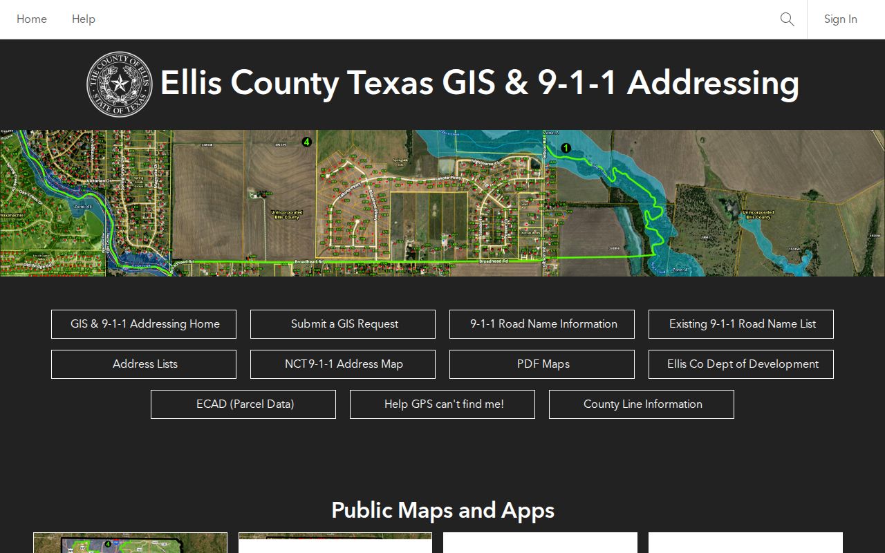
The map is a geography tool. A street match can help correct a road name or identify a surrounding parcel, but the county says its streets data is updated from 9-1-1 information. Compare it with the date and source of every other record.
- Adjacent parcel
- A mapped parcel that touches or sits immediately beside another parcel in the viewer at the recorded map date.
- Map ID
- An identifier shown in a map layer that can help reconnect the selected feature to another official record.
- Legal description
- The lot, block, subdivision, survey, or boundary language used to identify land in a recorded instrument.
- Owner mailing address
- An address for tax correspondence. It should not be treated as proof that the named party lives at the parcel.
Recorded Owners Near Ellis Neighbors
Once a parcel ID or legal description is known, Acclaim can supply the recorded-instrument index. Search by grantor or grantee, date, document type, instrument, volume and page, or legal description when available. The guest index and preview are separate from the full-image rules. A paid image or Clerk copy may be necessary to verify the document itself.
Recorded roles require care. A grantor may be a seller, trustee, lienholder, or estate representative. A grantee may be an individual, trust, or organization. Preserve the document type, party role, recording date, legal description, and instrument number. The deed trail can connect a party to an instrument, but does not establish a current household.
| Official block source | Best use | What not to infer |
|---|---|---|
| GIS selected parcel | Locate nearby mapped land and jurisdictions | A particular person lives at the address |
| ECAD account | Compare situs, legal description, and mailing context | Mailing information proves residence |
| Acclaim instrument | Verify a recorded party and land description | Every party is an owner or occupant |
Voter Records and Ellis Neighbors
Voter information is not a public block roster. The Ellis County voter registrar is at 204 East Jefferson Street in Waxahachie, with phone 972-825-5195. The county provides registration, address-correction, suspense-status, precinct-map, and status-route information. Texas voter registration can identify a registration record and precinct context, but it is not a guarantee that someone currently resides at the listed address.
Under Texas Election Code §18.008, a registration list may be requested from the registrar subject to the statute’s use notice and confidentiality exclusions. SOS guidance identifies public and protected fields separately. Social Security, driver-license, and personal-identification-card numbers are confidential. Address Confidentiality Program participants and other protected voters can have address detail suppressed or replaced. The state status screen was not available for field-level capture, so do not assume its current controls.
Note: Keep the request date, active or suspense selection, precinct fields, and any redaction notice with a voter-list result.
Ellis HOA Certificates by ZIP
The Texas HOA management-certificate search filtered to Ellis County can identify an association name, city, ZIP, type, and certificate link. It is a community-geography lead, not a membership list. The database says its certificates are user-provided and does not guarantee their completeness, reliability, or validity.
The Ellis County HOA certificate search is shown in this association-record capture.
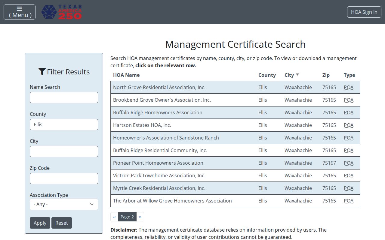
The search can establish an organization’s listed public record, then a parcel map, recorded plat, planning map, or public meeting record can supply further geographic context. Do not use it to infer a private roster.
Myrtle Creek Residential Association
Named in the Ellis-filtered certificate search. Use the official certificate route for listed association details and verify its date.
Sandstone Ranch
Named in the Ellis-filtered certificate search. The listing is an association lead, not evidence about individual households.
Victron Park Townhome
Named in the Ellis-filtered certificate search. Confirm any location through the official certificate and mapped parcel records.
Note: A management certificate can identify an Ellis association record, but it does not supply a reliable list of individual members or nearby households.
Waxahachie Context for Ellis Neighbors
Waxahachie adds city-level context to a block search. Its Locate page links neighborhood services, map resources, cemetery records, permits, and an open-records route. Use city sources to understand an address in that municipality, but do not extend a city map or permit system to every Ellis County community. Ennis and other cities keep their own municipal routes.
Waxahachie’s Locate page is the source for this Ellis neighbors neighborhood-map capture.

This city resource is useful for neighborhood context and local record routes. It does not identify private households or replace the county parcel and Clerk records.
Historic Blocks Behind Ellis Neighbors
For older block questions, use a dated sequence. Waxahachie’s 1946 official city map was revised from 1896 and 1922 maps, offering a documented continuity check for street layout. The July 1890 Sanborn map contributes footprint, use, lot, and street context. It does not identify present people or settle current ownership. The 1985 and 2004 historic-resource surveys add local research routes through deeds, tax rolls, directories, maps, photos, and newspaper microfilm.
The 2004 survey compared 1942 and 1955 directories to identify postwar neighborhood change. That is a useful model: compare only like-dated records, then verify a property change with an instrument, plat, permit, or other original source. Sims Library and the Portal to Texas History supply additional genealogy, microfilm, and digitized-newspaper leads when the date is part of the question.
The local newspaper collection is particularly useful when a map and a directory leave a gap. The Portal to Texas History describes 4,511 digitized Ellis County newspaper items dated from 1900 through 1917, including the Waxahachie Daily Light, Ferris Wheel, and Ennis Daily News. A published notice is still a dated source type of its own. Compare its name, address, and date with the recorded or map source rather than treating it as a modern block record.
Privacy Boundaries for Ellis Neighbors
Some block information remains private or unavailable. That includes household members not named in a relevant public record, people with no public filing tied to the address, utility customers and hookups, USPS delivery data, DMV addresses, protected voter addresses, juvenile or sealed court information, and nonpublic association rosters. A map or parcel result should not be used to reconstruct a protected person’s address.
The Texas Attorney General Address Confidentiality Program uses a substitute mailing address for eligible participants, and the SOS confidentiality guidance describes voter suppression and other confidentiality rules. Texas public-record access also has record-specific exceptions. Use the responsible custodian’s process when a record is protected or unavailable, rather than trying to combine separate sources around a private detail.