
Ellis County Previous Residents by Era
The most reliable route to past residents changes with the era. Deeds identify recorded parties and land descriptions. Tax rolls tie a taxpayer to a year. City directories offer a dated address snapshot, while maps explain a building, lot, or street context. None of those sources is a complete resident register. Used together, they make a defensible address history with every date and record type still visible.
| Source | Years it covers | Where held | What it can show |
|---|---|---|---|
| County Clerk deed books and indexes | 1845-1901 identified on the TSLAC guide | County Clerk and TSLAC reels | Transfer parties and legal land descriptions |
| Tax rolls | 1850-1910 | TSLAC reels 106901-106909 | Taxpayer and property-year bridge |
| Waxahachie city directories | 1895-1896, 1907, 1922, 1927-1928, 1942 | Sims, TSLAC, UNT, or other catalog holdings | Publication-year address and household notation |
| Sanborn map | July 1890 item | Library of Congress | Footprint, use, lot, and street context |
| Official Waxahachie maps | 1896 and 1922 source maps; 1946 revision | City PDF | Street-grid and address-continuity bridge |
| Probate, death, and divorce series | Probate 1850-1935; divorce 1899-1936 | County and district clerk routes; TSLAC | Heirs, fiduciaries, and family clues |
Start with the most recent dependable parcel record, then move backward. An address that appears to stop may have a different street format, a subdivision description, or an older lot-and-block description. The date and the place must travel with each name.
Start Ellis County Previous Residents at the Parcel
Ellis Central Appraisal District is the starting layer for the current account, situs address, owner or mailing relationship, legal description, taxing units, and any publicly displayed value or exemption fields. The public search form was not fully exposed during research, so field labels should be verified live rather than assumed. An owner mailing address is not proof of residence. Even a matching mailing and situs address is an address relationship, not certainty about every occupant.
Next, use the Ellis County GIS Portal to normalize the street address and note the selected feature, map date, parcel or map identifier where available, and city or district layers. County GIS supplies addressing and map context. It does not prove title or occupancy. The county’s interactive-map instructions document an address box with a dropdown selection, Layer List controls, and boundary or precinct groups.
If a desired existing appraisal record is unavailable in public search, the ECAD existing-record request form offers pickup, mail, fax, email, or other delivery. It lists letter copies at $0.10 per page and full-map charges of $15 without an aerial or $20 with one. Sales information has a statutory restriction under Government Code §552.148, so do not expect it as a general parcel-search result.
Trace the Ellis County Deed Chain Backward
After the parcel is identified, the County Clerk’s official-records system supplies the recorded-instrument layer. Acclaim allows free guest index searching. Its inspected name form accepts a personal or business name, matching mode, recorded-date range, party role, and document type. A guest index result and a document image are separate access events: research found index or preview access for guests, with registration and paid image or subscription options for full images, plus a mandatory $0.30 transaction fee.
The Acclaim grantor-grantee name search is the official form used to move from a current owner to an earlier transfer.
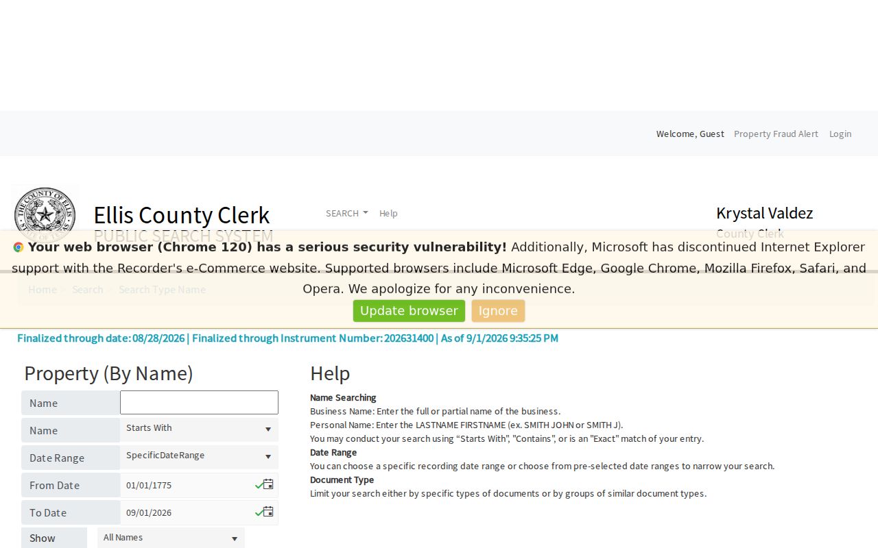
Search by legal party role and document type, then confirm the volume, page, or instrument in the record image or Clerk copy. A name-only deed hit does not establish that someone lived at the address.
- Save the current parcel’s legal description, account or map identifier, and situs address from ECAD or GIS.
- Find the current owner’s purchase deed or deed of trust in Acclaim and note the seller, buyer, recording date, document type, instrument number, and volume or page.
- Search the earlier seller as grantee, using the same legal description or subdivision as a check.
- Repeat one instrument at a time. A correction, release, probate affidavit, easement, or plat can explain a name without showing a full sale.
- When the accessible online trail ends, move to the Clerk’s older books or the identified TSLAC reels.
- Grantor
- The party transferring an interest in a recorded instrument. A grantor is not automatically an occupant.
- Grantee
- The party receiving an interest. A grantee can be a person, trust, organization, or estate-related party.
- Chain of title
- The sequence of recorded transfers or related instruments used to track an interest in the same land.
- Legal description
- The lot, block, subdivision, survey, abstract, acreage, or metes-and-bounds wording that identifies land beyond a street label.
When Ellis County Previous Residents Precede Acclaim
Older deeds require a different access channel. The TSLAC Ellis County microfilm guide identifies deed records from 1845 through 1901, direct A-Z indexes, reverse indexes, and original volumes by time range. It also warns that some original series were transcribed and may not be accurate. Verify a name, volume, page, and instrument in the filmed or original page before relying on a conclusion.
The guide identifies more than deeds. Tax rolls run from 1850 through 1910; marriages run from 1850 through 1934; probate inventories and case papers extend through the early twentieth century; and scholastic censuses cover 1933 through 1947. These records may be microfilm-only or incomplete, so a counter, library reference desk, or archive inquiry is the documented fallback when no online index supplies the answer.
The TSLAC Ellis County local-records guide is the source for the reel-level microfilm route.
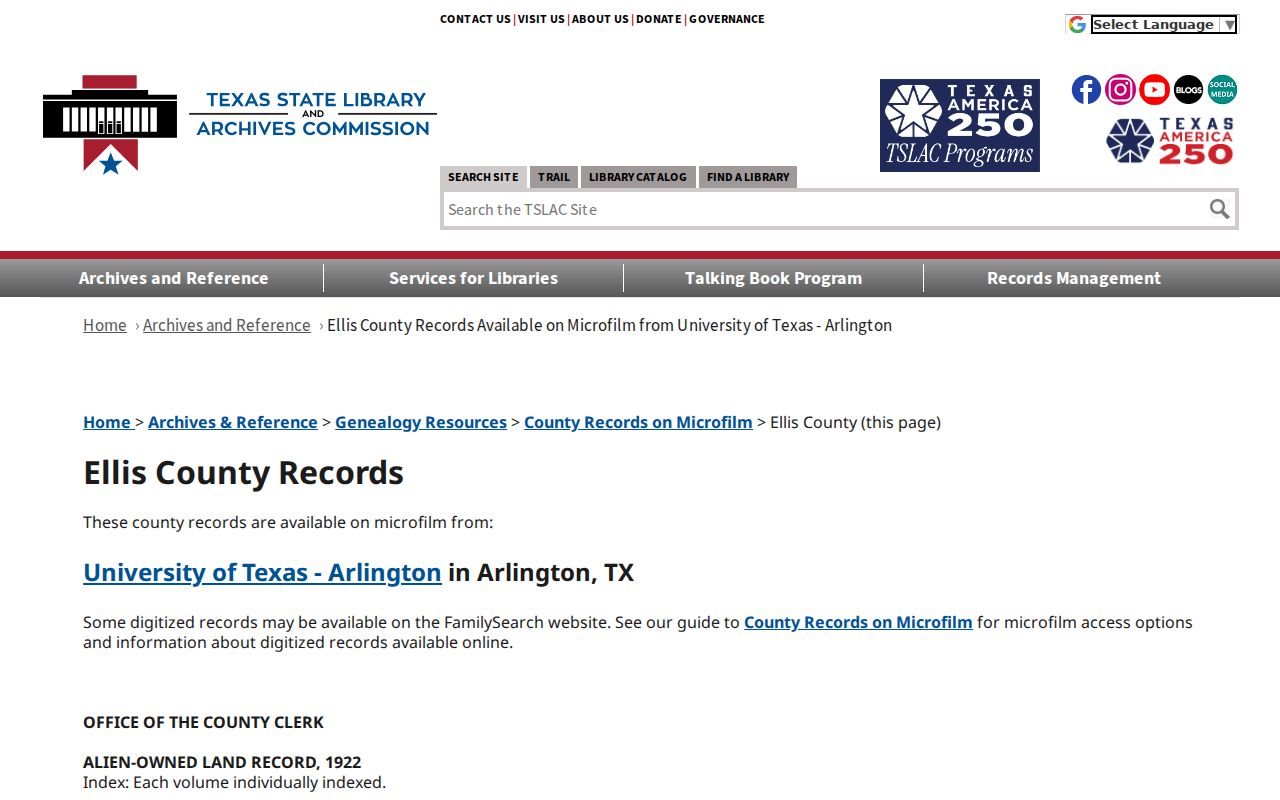
For older land, the legal description and adjoining owners may be more stable search tools than a modern street number.
Note: A microfilm index may be incomplete, so preserve the reel and page that support every historical address claim.
Map the Ellis County Address Before Assuming Change
Historic map work helps keep an address trail from breaking at the wrong point. The July 1890 Waxahachie Sanborn item contains four sheets. Sanborn maps can show street layout, lot boundaries, building footprint, materials, and use. They give built-environment context, not a complete list of residents or a title opinion.
The 1946 official Waxahachie map was revised from an 1896 map and a 1922 Texas Title & Loan map, then adopted in February 1946. That documented three-map connection is useful for comparing an older street or lot with a later grid. No official source established one countywide street-renumbering year. Differences are more safely treated as a formatting, growth, street-name, or jurisdiction question until the source confirms the change.
A permit can date construction, alteration, or an inspection, but may name an applicant or contractor rather than an owner. The Waxahachie permit and historic-resource route is a useful supporting source. No public countywide utility-customer or hookup database was located, so it should not be treated as an address-history source.
Pair Ellis County Directories With Census Years
Recorded owners are only part of a past household story. The known Waxahachie directory windows are 1895-1896, 1907, 1922, 1927-1928, and 1942. A printed entry may show an address, spouse, telephone, occupation, owned-or-rented notation, or business information. A public federal census is a single enumeration date. Comparing the two sources can help test whether an address and household were stable across an interval.
- Find the address or surname in the closest available directory edition and copy the year and page.
- Check a street or reverse section if the book provides one, while remembering that exact local reverse-directory coverage was not publicly verified.
- Compare the nearest public census household, allowing for spelling, marriage, widowhood, a move, or a missing directory year.
- Use a tax roll, deed, map, newspaper, cemetery clue, or probate file to resolve a change rather than guessing its cause.
The latest fully public decennial census is 1950 under the 72-year release rule. The historical collection details and how to read each entry belong with the Ellis County City Directory records, rather than a parcel-chain search.
Ellis County Previous Residents Before Modern Cards
Ellis County’s historical timeline reaches farther than a modern appraisal card. TSLAC identifies deed microfilm beginning in 1845 and tax-roll reels beginning in 1850. Those dates make the county’s older land and tax series valuable for estate research, family history, and local history when a twentieth-century address is not yet part of the record. They do not mean every property or person is indexed online.
Waxahachie became the county seat in 1850, and the present Historic Courthouse dates from 1897. The county describes a record-safe vault and metal shutters as part of its preservation story. The surviving record pattern is mixed: some early volumes are available, others are incomplete or unavailable, and no single countywide loss explains every gap. Search the relevant series by reel, volume, page, case number, and index type.
Close Ellis County Previous Residents Carefully
Probate, death, obituary, cemetery, and newspaper records can help close an address trail. TSLAC identifies probate inventories from 1851 through 1935, probate case papers from 1850 through 1930, and death series from 1923 through 1982, with some volumes unavailable. A probate file may identify an heir, fiduciary, or estate representative. That role should not be rewritten as a resident relationship without another record.
The Ellis County Area Newspaper Collection holds 4,511 digitized items dated 1900-1917, including the Waxahachie Daily Light, Ferris Wheel, and Ennis Daily News. Sims has local newspaper microfilm and vertical files. An obituary or notice can supply a date, spouse, or place clue, but confirmation should come from the relevant vital, probate, or recorded source when the fact matters.
Use Ellis County Address History Lawfully
Address history is well suited to family history, estate and heir questions, historical research, and personal property curiosity. It is not a reason to treat recorded parties as a current household list. A deed party may be a trustee, lienholder, estate representative, or organization. A map can show a parcel without naming an occupant, and a tax record can show a taxpayer without listing the full household.
Lawful use. Use Ellis County previous residents records for legitimate personal and historical research. Do not use public records to stalk, harass, or harm any person.
For a Clerk copy or older-record question, the Ellis County Clerk’s Property Recording office is at 109 South Jackson Street in Waxahachie, with property-record phone 972-825-5070 and a mailing address of PO Box 250, Waxahachie, TX 75168. The Clerk’s fee schedule distinguishes recording from requesting an existing record. Verify the current fee and payment instructions before ordering.