
Ellis ZIP Code Postal Routes
Ellis County sources identify the working postal routes below. The table is deliberately not an exhaustive county certification. USPS service areas can cross city and county lines, and the captured county GIS material does not publish a complete static ZIP list. Use it as a starting set for Ellis address research, then confirm the delivery ZIP and parcel location for the specific street address. Nearby Rice, Dallas, Tarrant, Johnson, Kaufman, and other regional routes should not be added simply because a map or mailing label looks close.
| ZIP | Area located in Ellis sources | Postal evidence | Research note |
|---|---|---|---|
| 75101 | Bardwell, Ellis County | Bardwell USPS location | Small local route; postal city is not a city-limit test |
| 75119 | Ennis, Ellis County | Ennis Post Office | Principal Ennis route; municipal and county records stay separate |
| 75120 | Ennis, Ellis County | USPS manual and local references | Verify current delivery assignment for an exact address |
| 75125 | Ferris, Ellis County context | Government-linked county references | Ferris can appear in both Ellis and Dallas contexts |
| 75152 | Palmer, Ellis County | USPS and local references | Use ECAD and GIS for taxing or municipal boundaries |
| 75154 | Red Oak and Ovilla, Ellis area | ZIP and county references | Confirm each address at the developing municipal edge |
| 75165 | Waxahachie, Ellis County | Waxahachie Post Office | County-seat route; included in local USPS delivery material |
| 75167 | Waxahachie, Ellis County | Waxahachie postal route | Common rural or outer route, not a city-limit test |
| 75168 | Waxahachie, Ellis County | Waxahachie postal route | Postal city can differ from an incorporated boundary |
| 76041 | Forreston and rural Ellis area | Government-linked county references | Verify street by street with USPS and GIS |
| 76064 | Maypearl, Ellis County | Government-linked county references | City, county, and school layers can differ |
| 76065 | Midlothian, Ellis County | Government-linked county references | Check the exact parcel county and municipal location |
For local postal offices, the Ellis research located Bardwell at 100 Ellis Street, Ennis at 205 North McKinney Street, and Waxahachie at 316 North College Street. Those Ellis County office locations support the route references, but a street address still needs its own USPS result. The Ellis ZIP code directory works as a route guide, not a claim that all addresses sharing a postal city sit inside the same local government boundary.
Note: The available Ellis evidence supports this working table, but current USPS and GIS checks are needed before treating any route as countywide or complete.
Ellis ZIP Code Office Clues
Bardwell, Ennis, and Waxahachie are the strongest documented Ellis County postal reference points. Ennis has 75119 and 75120 in the captured USPS and local materials. Waxahachie is represented by 75165, 75167, and 75168. Postal labels remain delivery tools, not legal descriptions. A postal city can be used on an address outside city limits, and a parcel's taxing, school, emergency-service, election, or municipal layer can point elsewhere. The active Ellis taxing-unit structure makes that distinction important.
Use a postal route to choose the first verification source, then preserve the result with the exact street format. If a search concerns civic districts, open the Ellis County GIS Portal after the postal check. Ellis County GIS can identify an address, its map context, and boundary layers. It should not be treated as proof of who receives mail or who occupies a property.
Verify an Ellis ZIP Code
USPS offers the most direct check for delivery formatting. Search the complete delivery address when it is available, or use the city and state route when the task is to find possible postal codes. The result is a postal normalization, not a confirmation of a person, organization, county, or parcel. Save the exact input and returned address form. That record makes it easier to compare an Ellis County GIS address selection, Ellis ECAD appraisal account, or Ellis County Clerk legal description without assuming the labels must match word for word.
- Enter the exact delivery address in the USPS ZIP Lookup and retain the returned street, city, state, and postal code.
- Use the Ellis County GIS address box and its dropdown selection to compare the normalized address with parcel, road, city, district, and precinct context.
- Check Ellis ECAD for the appraisal account, situs, owner mailing relationship, legal description, and taxing-unit context. Its live search fields were not captured, so verify the current interface before relying on a ZIP filter.
- When the question turns to a street segment or adjacent parcel, continue with the Ellis street directory record path rather than treating the postal code as a block roster.
| USPS search mode | Input to provide | What the result means |
|---|---|---|
| Address lookup | Full delivery address | Postal city and delivery ZIP normalization |
| City and state lookup | City name and state | Possible postal-code route information |
The USPS ZIP Lookup page is captured below. It offers address and city/state modes, while warning that a postal result does not identify a person or organization.
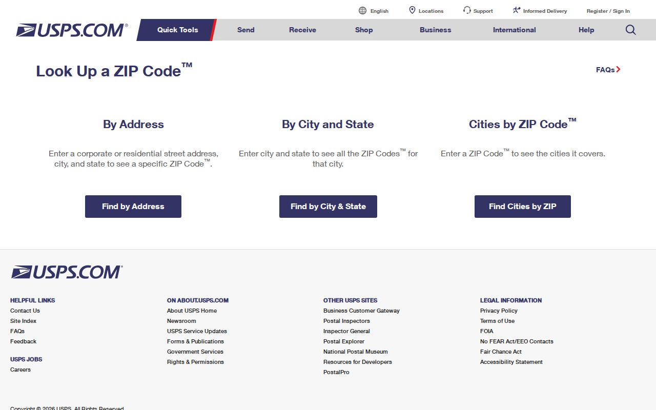
Use the USPS result first for deliverability, then compare Ellis County records for the jurisdiction and parcel question that follows.
Ellis ZIP Search Channels
ZIP-filtered access is uneven across Ellis sources. USPS accepts an address or city and state. The Texas HOA certificate database provides a ZIP filter alongside county, city, and association type. The Ellis County GIS instructions document address selection and map layers, not a ZIP-wide resident search. Ellis ECAD's public entry point was captured, but its exact live field options require manual verification. The statewide voter status route is for an individual's status, not a public ZIP-wide list; an Ellis voter-file request follows a separate registrar or Secretary of State process with confidentiality limits.
Use the Ellis tool according to what it can establish. A homeowner association certificate can name an association and supply city and postal data, but its database is user-provided and disclaims completeness, reliability, and validity. Ellis GIS can show an address's dated map and layer context. Ellis ECAD can supply appraisal context. Neither converts a ZIP into a directory of named occupants.
Note: A ZIP filter returns records carrying a mailing or location field; it does not identify every person who lives within that postal area.
Ellis ZIP and Parcel Labels
One Ellis property can have three useful location keys. The mailing address is where correspondence goes. The situs address is the physical property location used in appraisal context. The legal description identifies the Ellis land through lot, block, subdivision, survey, abstract, acreage, or metes-and-bounds language in a recorded instrument. A postal code can appear with the first two labels, but it is not a substitute for the legal description when tracing an Ellis deed or plat. Preserve each label exactly as the source uses it.
The Ellis County Clerk's Acclaim index is the recorded-property route for party, instrument, date, and legal-description research. The Ellis Central Appraisal District is the appraisal layer. If an address differs across those Ellis sources, compare the account, map identifier, deed reference, and record date before deciding that the sources describe different property.
Ellis ZIP Code Boundary Gaps
An Ellis postal boundary and an Ellis city boundary are different systems. Ferris can appear in both Ellis and Dallas contexts. The Ellis Red Oak and Ovilla area requires an exact address check at a fast-changing municipal edge. Forreston and other rural-edge addresses can carry an Ellis connection without acting like a city-limit label. County, city, school, water, justice, commissioner, and voting layers may all be different for one address. Check Ellis parcel and map layers before using a ZIP result to identify an agency or jurisdiction.
- ZIP and ZIP+4
- A ZIP identifies a delivery area. ZIP+4 adds a more specific delivery segment within that area.
- PO-box ZIP
- A code used for post-office boxes that may differ from the delivery code for a nearby street address.
- Unique ZIP
- A postal code assigned to a single organization or large delivery point, when USPS designates one.
- Carrier route
- A mail-delivery sequence used by USPS. It is not a parcel boundary or a list of confirmed occupants.
Ellis ZIP Code Directory Terms
The Ellis ZIP code directory is most reliable when its labels are kept separate. A postal city is the city name USPS uses for delivery. A mailing address can differ from an appraisal situs. A map layer can show a school, water, justice, commissioner, or voting district that has no postal meaning. A recorded plat can establish lot and block information while an Acclaim instrument identifies a party and recording date. Each label helps answer a different question, so record both the source and the date of the result.
For a historical Ellis address, modern postal labels can be especially misleading. Waxahachie's 1946 official city map was revised from 1896 and 1922 maps, showing why street and place continuity needs dated records. Use city maps, directories, deeds, and plats for historical location work, not a current ZIP alone.
Ellis ZIP Code Precinct Changes
Voting precincts are not postal routes. Ellis County's redistricting material says precinct 1006 split into 1006 and 1060, while precinct 1038 split into 1038 and 1061. The maps were accepted in April 2025 and the changes took effect January 1, 2026. A ZIP did not change merely because a precinct changed. For a current election-geography question, check the county's voter-registration information, the current redistricting maps, and the GIS voting-precinct layer for the exact address.
The Ellis registrar identifies registration status, precinct, and district geography, with public-record and confidentiality rules. Texas does not register voters by party. A voter route is therefore useful for its own dated election purpose, not as a postal-area list of residents.
Ellis ZIP Geography by Numbers
Ellis County describes itself as about 952 square miles, including about 940 land and 12 water, with 15 cities, seven towns, and unincorporated communities such as Avalon, Forreston, and Telico. That scale explains why a postal label is only one of several local place systems. A person, parcel, or public record can be associated with an Ennis mailing label, a Waxahachie record office, an Ellis tax roll, and a state filing without those labels being interchangeable.
County growth also heightens the need for dated verification. Census QuickFacts estimated an Ellis County population of 240,867 on July 1, 2025, compared with 192,455 in the 2020 Census. Those figures describe the county as a whole, not a source for identifying individuals. Keep a postal search focused on its delivery purpose and compare local records by jurisdiction and date.
Ellis ZIP Association Listings
The Texas HOA management-certificate search can filter by Ellis County, city, association type, and postal code. It returned association names including Myrtle Creek Residential Association, Sandstone Ranch, Victron Park Townhome, Pioneer Point, Legacy Estates, Arbor at Willow Grove, Cottages on Cantrell, Waterfall Ranch, Tuscan Estates Waxahachie, and Estates of Hidden Creek. Those names are leads to governing documents and local boundaries. They are not a membership roster or proof that any named person lives in the area.
The Texas HOA certificate search filtered to Ellis County is shown below.
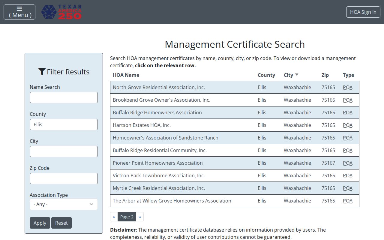
The state database warns that certificates are user-provided and may be incomplete or unreliable. Verify an association's current status and boundaries directly before relying on a result.